
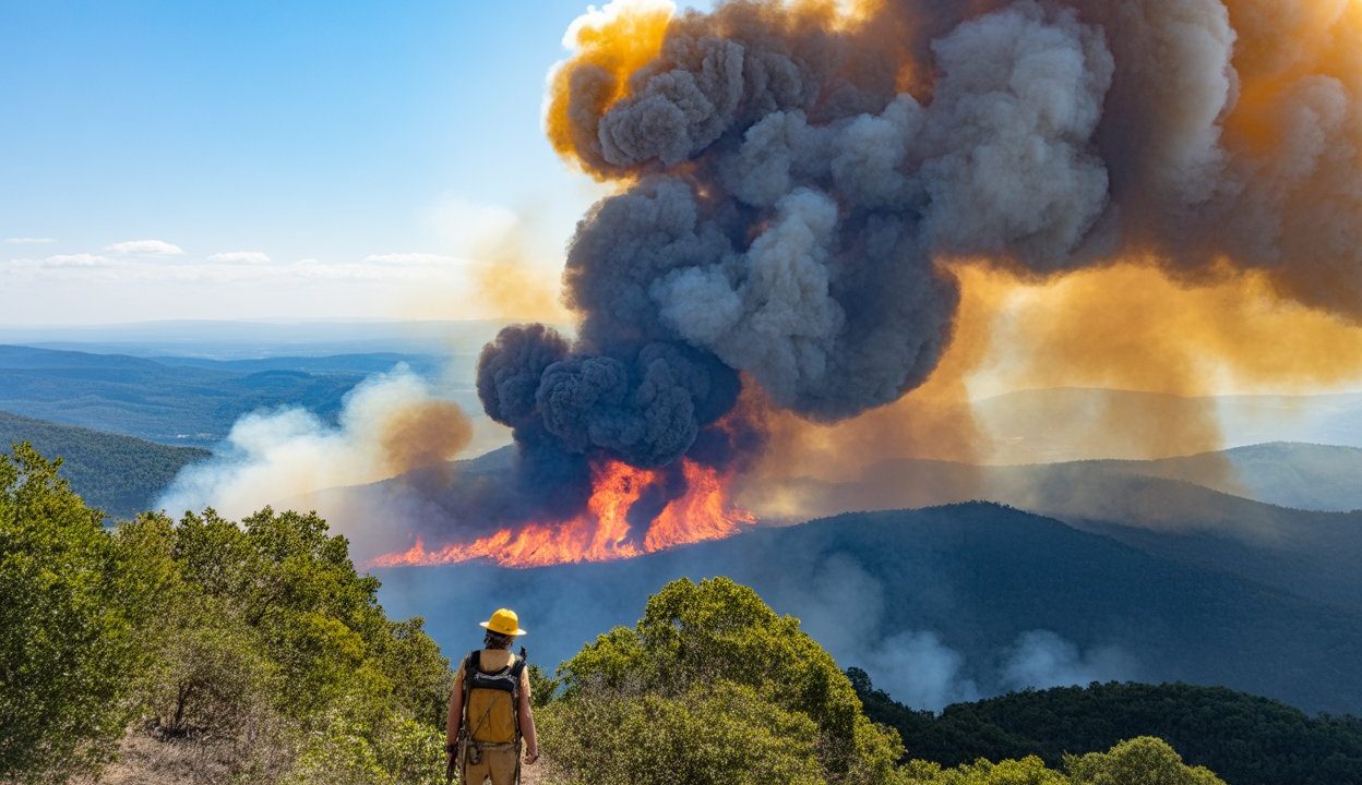
When a forest fire breaks out on a mountain at night, the challenges multiply fast. Visibility drops to near zero, terrain becomes treacherous for ground crews, and the window for accurate damage assessment closes almost entirely. That is precisely the scenario that played out during the Mount Ogi forest fire in Japan — and it is where drone technology stepped in to fundamentally change how emergency responders operated.
Blue Innovation Co., Ltd. deployed drones during the Mount Ogi forest fire in 2026, marking what observers are calling a significant shift in how Japan approaches nighttime wildfire response. The operation demonstrated that drones could provide real-time intelligence, map active hotspots, and support firefighting teams in conditions that would otherwise leave commanders working blind.
The implications stretch well beyond a single fire on a single mountain. As Japan faces ongoing wildfire risks across its heavily forested regions, the ability to conduct effective aerial operations after dark could reshape emergency management at a national level — and reduce the kind of travel disruption and regional chaos that major wildfires routinely cause.
How Drones Transformed the Mount Ogi Fire Response
The Mount Ogi deployment centered on a core problem: nighttime wildfires are among the hardest emergencies to manage. Ground crews face serious safety risks navigating unfamiliar mountain terrain in darkness. Aerial manned aircraft have strict operational limits after sunset. And without accurate mapping, resources get deployed inefficiently — sometimes dangerously so.
Blue Innovation’s drones addressed this directly. By flying at night over the fire zone, the unmanned systems were able to gather thermal and visual data that human observers simply could not obtain from the ground. That data fed directly into the operational picture for firefighting teams, giving commanders a clearer understanding of where the fire was spreading, where hotspots remained active, and where crews could safely work.
The deployment also supported mapping operations in real time. Rather than waiting until daylight to assess fire boundaries and affected terrain, response teams had access to updated imagery and data through the night. That kind of continuous intelligence is exactly what modern disaster response frameworks are designed around — and until recently, it was extremely difficult to achieve in mountainous, low-visibility conditions.
What the Operation Actually Involved
Based on what is confirmed from the Mount Ogi deployment, the Blue Innovation operation covered several key functions:
- Nighttime aerial surveillance of the active fire zone, providing visibility that ground teams could not achieve independently
- Real-time hotspot mapping, identifying where fire remained most intense and where it was spreading
- Support for firefighting teams, giving crews on the ground better situational awareness before advancing into dangerous areas
- Enhanced safety planning, allowing commanders to route personnel away from the highest-risk zones
- Continuous intelligence gathering through the night rather than relying on periodic daytime assessments
| Capability | Traditional Nighttime Response | With Drone Deployment |
|---|---|---|
| Aerial visibility at night | Severely limited or unavailable | Active drone surveillance maintained |
| Hotspot mapping | Delayed until daylight | Real-time mapping throughout the night |
| Ground crew safety data | Minimal aerial support | Continuous overhead intelligence feed |
| Fire boundary assessment | Post-event or delayed | Updated in real time during the operation |
Why This Matters for Travel and Regional Disruption
Wildfires in Japan’s mountain regions do not just threaten the immediate fire zone. They trigger road closures, disrupt rail links, force evacuations of nearby communities, and can shut down tourism corridors for days or weeks. Mount Ogi, like many of Japan’s forested peaks, sits within a region that draws hikers, nature tourists, and visitors to surrounding towns.
When fires are contained faster and more accurately — when commanders know exactly where the fire is and where it is not — evacuation orders can be more precisely targeted. Roads that are genuinely out of danger can stay open. Communities that are not in the fire’s path do not need to be disrupted unnecessarily.
That is the link between drone-assisted disaster response and travel disruption. Better intelligence means faster, more proportionate responses. Faster responses mean shorter closure windows. And shorter closure windows mean less chaos for the travelers, residents, and local economies caught in the blast radius of a major wildfire event.
Supporters of expanded drone use in disaster management argue that the technology also reduces risk to human responders. When drones can survey terrain that would otherwise require a crew to enter, the calculus of where to send people changes significantly.
What Comes Next for Drone-Based Disaster Response in Japan
The Mount Ogi deployment is being viewed as a marker of where emergency operations technology is heading in Japan. The country faces persistent wildfire risk across its mountainous interior, and the limitations of traditional nighttime response have long been a recognized weakness in disaster management frameworks.
Blue Innovation’s operation demonstrates that the technology exists to address those limitations now — not at some future point. The question moving forward is how quickly these capabilities get integrated into standard disaster response protocols across Japanese prefectures and emergency agencies.
There is also the broader question of regulatory frameworks. Operating drones at night, over active fire zones, in mountainous terrain requires specific approvals and operational protocols. The fact that this deployment occurred and produced useful results suggests that at least some of those frameworks are already in place or were cleared for this operation.
For the communities, travelers, and regional economies that live and operate near Japan’s forested mountains, the direction is encouraging. Technology that reduces the window of uncertainty in a wildfire — that tells responders where the fire actually is at 2 a.m. rather than at sunrise — is technology that directly protects lives, property, and the normal flow of daily life.
Frequently Asked Questions
Who deployed drones during the Mount Ogi forest fire?
Blue Innovation Co., Ltd. conducted the drone deployment during the Mount Ogi forest fire in 2026.
What were the drones used for during the fire?
The drones were used for nighttime aerial surveillance, real-time hotspot mapping, and providing intelligence to support firefighting teams and safety planning.
Why is nighttime drone deployment significant in wildfire response?
Traditional aerial support is severely limited after dark, meaning fire commanders previously had to wait until daylight for accurate assessments — a delay that can allow fires to spread unchecked.
How does faster fire response reduce travel disruption?
More precise intelligence allows for more targeted evacuation orders and shorter closure windows, meaning roads and communities outside the actual danger zone face less unnecessary disruption.
Has Blue Innovation used drones in other disaster response operations?
Will drone-based nighttime disaster response become standard practice in Japan?
The Mount Ogi deployment is being seen as a significant step toward that outcome, though the timeline for broader adoption across Japanese emergency agencies has not been confirmed.



Leave a Reply