
▶ Read transcript
Here’s what you need to know about China’s sinking coastal cities and why scientists are calling this a crisis four thousand years in the making.
Researchers at Rutgers University found that sea levels stayed remarkably stable for roughly four millennia before the 1800s. Since then, the pace of rise has accelerated sharply, and scientists estimate we’re already locked into about six inches of additional rise by 2050.
China’s coastal megacities face a dangerous double threat. The ocean is climbing toward them while the ground beneath them sinks away. In cities like Tianjin, at least 94 percent of that sinking is linked to human activity, mainly groundwater extraction. When land drops 10 millimeters per year and the sea rises 5, the combined effect is three times the global average.
Here’s your takeaway. If you want to understand the real scale of this story, look up your own city’s flood risk data. Coastal vulnerability is rarely just about the ocean — it’s about what’s happening underground too.
What would you do if the city beneath your feet was quietly disappearing into the sea? Not in a dramatic, Hollywood-disaster way, but slowly, measurably, millimeter by millimeter, year after year, until the math no longer worked in your favor?
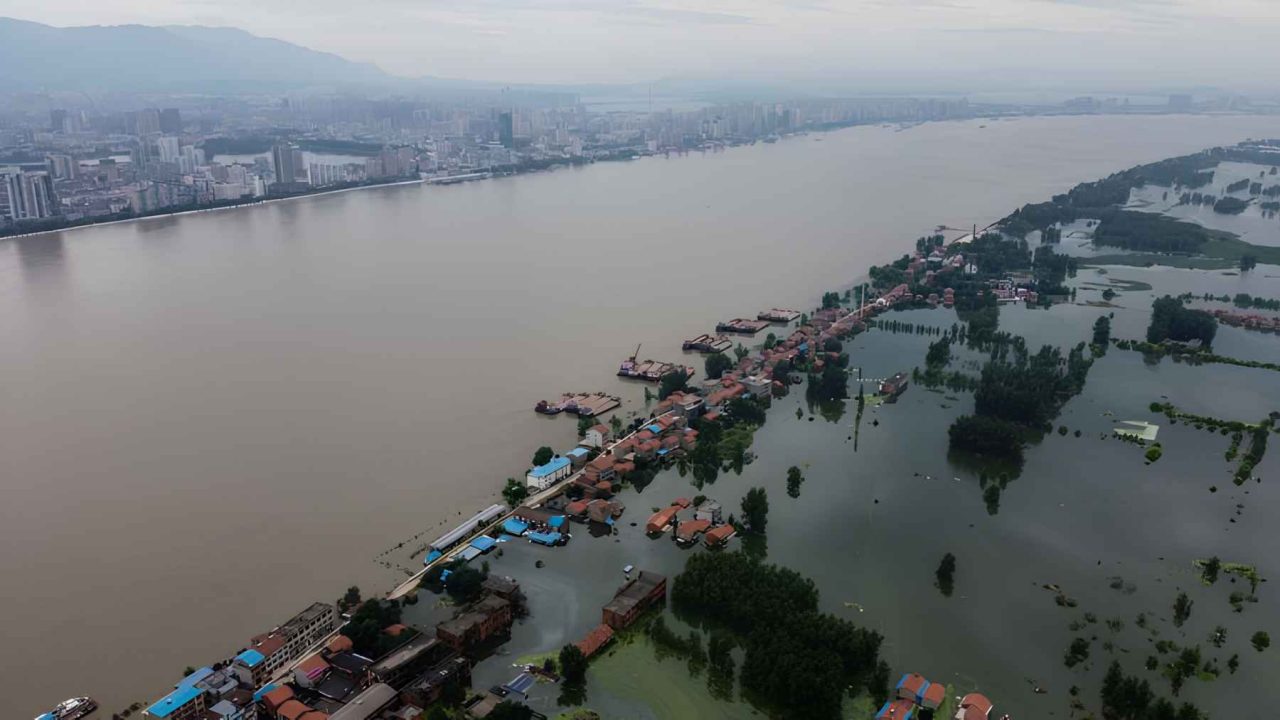
That question is no longer hypothetical for tens of millions of people living along China’s coastline. Sea levels are rising at a rate not seen in at least 4,000 years, according to researchers at Rutgers University. And China’s coastal megacities are caught in a double bind: the ocean is climbing toward them while the ground beneath them sinks away.
This is a countdown of the five most urgent pressure points in that unfolding crisis, ranked by the scale of human exposure, the speed of change, and the complexity of the challenge ahead.
Why the 4,000-Year Benchmark Changes Everything
To understand the urgency, you need to appreciate what scientists actually did to reconstruct this history. Researchers used thousands of natural markers, including ancient coral reefs and mangrove sediments, to rebuild sea level timelines stretching back millennia. A statistical tool called PaleoSTeHM was then used to combine multiple geological records into one coherent reconstruction.
The result was striking. For four millennia, sea levels barely moved. Then, starting in the 1800s, the line on the graph began to climb. Coauthor Robert Kopp helped connect that long geological record to modern tide gauge measurements, bridging ancient sediment data with satellite-era precision.
“Scientists studying sea-level rise have been using methods that underestimate how high the water already is.”
— The New York Times, March 2026
A 2020 analysis confirmed that ice loss has been a major contributor to sea-level rise since 1900, alongside the thermal expansion of warming oceans. Greenhouse gas emissions warm the atmosphere and ocean, accelerating ice sheet and glacier melt while simultaneously causing seawater to physically expand and take up more space.
Scientists now estimate we are already locked into around 6 inches of global sea level rise by 2050. But their calculations may be starting from a baseline that is already too low.
Sea level rise is also not uniform. As NASA’s sea level team explains, ocean dynamics and Earth’s uneven gravitational field mean some coastlines experience far more rise than the global average. China’s eastern seaboard sits in one of those accelerated zones.
Pressure Points 5 Through 2: Cities Already Counting the Cost
Tianjin: The Port City Subsiding Faster Than the Sea Rises
Tianjin, one of China’s largest port cities, faces a problem that is almost counterintuitive. The sea does not need to rise very far when the land is falling to meet it. At least 94% of rapid modern urban subsidence in China’s coastal region is linked to human activity, not natural geological settling.
In Tianjin’s case, decades of groundwater extraction for industrial and residential use have caused the urban core to sink at rates that, in some districts, outpace the rise of the sea itself. The city sits on soft alluvial sediment, which compresses as water is removed from underground aquifers. The result is a narrowing gap between street level and flood level that engineers measure in centimeters per year.
Guangzhou: A Pearl River Delta Under Pressure
Guangzhou anchors the Pearl River Delta, one of the most densely populated and economically productive coastal regions on Earth. The delta itself is a vast, low-lying plain built from centuries of river sediment. That same sediment is now compacting under the weight of one of the world’s largest urban agglomerations.
Storm surges from typhoons, which are intensifying as ocean temperatures rise, push seawater inland through the delta’s intricate network of channels. As the land settles and the sea climbs, the buffer zone between safety and inundation shrinks. Infrastructure built to handle 1990s flood levels is already being stress-tested by conditions that were not expected for another two decades.
Shenzhen: The Tech Capital With a Flood Exposure Problem
Shenzhen grew from a fishing village to a city of 17 million people in roughly 40 years. That speed of construction, while economically remarkable, created a coastline heavily modified by land reclamation. Reclaimed land, built on dredged sediment and fill, is particularly vulnerable to both subsidence and flooding.
You are the infrastructure planning director for a major coastal Chinese city. New data shows your city is sinking 12mm per year from groundwater extraction while sea levels rise 5mm per year. A proposal to ban new groundwater extraction would save the city long-term but cause short-term water shortages affecting millions of residents. What do you prioritize?
Shenzhen’s western districts face direct exposure to the Pearl River estuary. Rising seas threaten not just residential neighborhoods but the logistics corridors and technology campuses that drive a significant portion of China’s export economy. The economic stakes of inaction are not abstract.
Ningbo: Where Ancient Port History Meets Modern Flood Maps
Ningbo has been a trading port for over a thousand years. Its position at the mouth of several converging rivers made it valuable for commerce. That same geography now makes it a funnel for floodwater during extreme weather events.
Ningbo’s flood risk is compounded by its role as a critical node in global supply chains. The port of Ningbo-Zhoushan is among the busiest container ports in the world. A major flood event does not just affect local residents; it sends ripples through manufacturing and shipping networks that span continents. Scientists have uncovered what some describe as a blind spot in sea-level research, revealing that tens of millions of people thought safe from coastal flooding are actually at greater risk than current models show.
Shanghai: The Number One Front Line in China’s Sea Level Crisis
No city in China, and arguably no city in Asia, illustrates the convergence of rising seas and sinking land more vividly than Shanghai. It is the most instructive case precisely because it is both the most alarming and the most hopeful.
In parts of Shanghai, the ground dropped by more than 3 feet during the 20th century. That staggering figure was driven primarily by one factor: heavy groundwater pumping to supply a rapidly industrializing and urbanizing metropolis. As aquifers were drained, the soft sediment above them compressed. Entire neighborhoods settled. Infrastructure cracked. Flood risk multiplied.
| City | Primary Risk Factor | Subsidence Driver | Population Exposed |
|---|---|---|---|
| Shanghai | Land subsidence + sea rise | Groundwater extraction | ~24 million |
| Guangzhou | Delta flooding + storm surge | Sediment compaction | ~18 million |
| Tianjin | Industrial subsidence | Groundwater + construction load | ~14 million |
| Shenzhen | Reclaimed land vulnerability | Dredged fill compaction | ~17 million |
| Ningbo | Supply chain disruption risk | River delta settling | ~9 million |
Then something significant happened. Shanghai began tightening regulations on groundwater use. The city invested in alternative water sources, enforced extraction limits, and monitored subsidence rates systematically. The results were measurable. Shanghai’s subsidence rate slowed considerably after those interventions took hold.
This matters enormously, because it proves that at least one half of the double bind is within human control. The city cannot stop the sea from rising. But it demonstrated that it could slow the sinking.
Shanghai’s population of roughly 24 million people lives largely on land that sits only a few meters above sea level. The Huangpu River, which bisects the city, is held back by a network of flood barriers and levees. Those barriers were engineered for the sea levels and storm intensities of the late 20th century. Each year of additional rise narrows the safety margin they were designed to provide.
The broader lesson from Shanghai is that the crisis is not binary. It is not a choice between a city that survives and one that drowns. It is a continuous negotiation between human systems and physical forces, where policy decisions made today determine how much negotiating room exists in 2040 or 2060.
What the 4,000-Year Record Tells Us About the Next 25 Years
The paleoclimate record assembled by Rutgers researchers and others is not just a history lesson. It is a calibration tool. By understanding how sea levels behaved across millennia, scientists can better constrain projections for the decades ahead.
The record shows that the current rate of rise, roughly 1.5 millimeters per year since 1900 on a global average, is unprecedented in the 4,000-year window studied. It also shows that the rate is not constant. The pace has been accelerating, driven by increasing ice loss and ocean warming as greenhouse gas concentrations climb.
For China’s coastal cities, the 2050 horizon is particularly significant. Infrastructure built today, from subway tunnels to flood barriers to residential towers, will still be in service when the locked-in 6 inches of sea level rise arrives. Engineers designing those systems now must plan for a coastline that will look meaningfully different within their own lifetimes.
The research also highlights what some scientists call a blind spot in current risk assessments. Tens of millions of people assumed to be safely above flood thresholds may not be, once updated elevation data and subsidence rates are factored in. The populations at risk are larger than official figures suggest.
Shanghai showed that a city can slow its own sinking. The harder question, the one no single city can answer alone, is whether the world can slow the rising. The 4,000-year record makes clear that the ocean has been patient. The question now is whether human institutions can move faster than the tide.


Leave a Reply