
▶ Read transcript
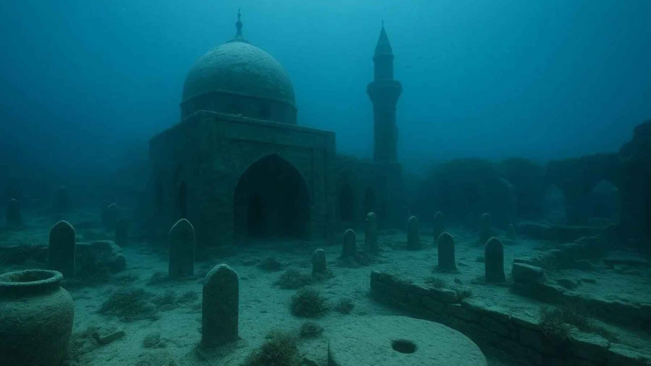
Here’s what you need to know about a remarkable archaeological discovery in Kyrgyzstan. Beneath the turquoise waters of Lake Issyk-Kul, the country’s largest lake, archaeologists have confirmed the existence of a medieval city sitting on the lake floor, preserved under three to thirteen feet of water. This isn’t a small settlement. Divers found brick buildings, kiln complexes, metallurgical workshops, and a massive Muslim cemetery spanning roughly 650,000 square feet, dating to the 13th or 14th century. The discovery challenges the long-held assumption that Kyrgyzstan was merely a transit corridor along the Silk Road, revealing it was home to a significant urban center with industrial-scale production and active trade networks. Researchers believe a major 15th century earthquake raised the lake’s water levels, swallowing the city whole. If you’re interested in Silk Road history, keep an eye on this site because mapping is still incomplete, and there’s likely much more to uncover.
Atlantis never existed. Plato made it up. Most historians agree the legendary sunken kingdom was a philosophical allegory, not a real place. Yet the obsession with drowned cities persists because, every so often, one actually turns out to be real.
Beneath the cold, turquoise waters of Lake Issyk-Kul in Kyrgyzstan, archaeologists have confirmed something extraordinary. A medieval city sits on the lake floor, its walls and buildings preserved under 3 to 13 feet of water. This is not myth. This is brick, bone, and ceramic.
And it changes what we thought we knew about the Silk Road.
The Comfortable Myth: Central Asia’s Silk Road Was Well Mapped
For decades, the dominant assumption among historians has been straightforward. The major Silk Road cities were known. Samarkand, Bukhara, Kashgar, and dozens of other stops had been excavated, cataloged, and placed neatly on maps. Central Asia’s role in global medieval trade was considered well understood.
Kyrgyzstan, in this narrative, served mostly as a transit corridor. Caravans passed through the Chui Valley, crossed the Bedel Pass into China, and moved on. The region was a highway, not a destination. Few expected to find a significant urban center hiding in plain sight, let alone one submerged beneath the country’s largest lake.
Lake Issyk-Kul is enormous, ringed by the Tien Shan mountains, and never freezes despite sitting at 5,270 feet elevation. Local legends have long whispered about structures visible through the water on calm days. But legends are easy to dismiss.
Most scholars did exactly that.
Cracks in the Lake Floor: Early Hints That Something Lay Below
The first real crack in the assumption came not from divers but from satellite imagery and local reports. Fishermen near the village of Toru-Aygyr had pulled up fragments of pottery and worked stone for years. Occasional reports surfaced of geometric shapes visible beneath the surface during low-water periods.
Then came the systematic expeditions. Between 2023 and 2024, teams from the National Academy of Sciences of the Kyrgyz Republic deployed divers to survey the lake floor near Toru-Aygyr. What they found was not a scattered collection of artifacts. It was a city.
“This is not a village or a temporary camp. The scale of the structures, the kiln complexes, the necropolis; this was an organized urban settlement.”
— Valery Kolchenko, National Academy of Sciences of the Kyrgyz Republic
Archaeologist Valery Kolchenko led the identification effort. His team mapped four separate areas on the lake floor containing walls, wooden beams, and dense concentrations of pottery. Brick buildings and kiln complexes were documented beneath the water. This was industrial-scale production, not a pastoral settlement.
What the Lake Floor Actually Revealed
The evidence dismantles the idea that Issyk-Kul’s shores hosted only small, transient communities. The submerged site tells a different story entirely.
Divers collected broken ceramics, animal bones, and slag from the ruins. Slag is the waste product of metal heating and refining. Its presence signals that this city had active metallurgical workshops. Metalworking at this scale implies trade networks, raw material supply chains, and a population large enough to sustain specialized labor.
| Evidence Type | What Was Found | What It Indicates |
|---|---|---|
| Brick buildings | Multi-room structures with kiln complexes | Permanent urban construction, industrial activity |
| Ceramics | Broken pottery fragments across four zones | Domestic life, possible trade goods |
| Slag | Metal refining waste material | Active metallurgical workshops |
| Animal bones | Fragments from multiple species | Livestock economy, food processing |
| Muslim necropolis | Cemetery spanning ~1,000 × 650 feet | Large, established Muslim community (13th-14th century) |
| Human remains | Two individuals, faces oriented toward Mecca | Islamic burial practices, cultural identity |
Perhaps the most striking discovery was the Muslim necropolis. Documented near the ruined buildings, the cemetery covers roughly 1,000 by 650 feet. That is a massive burial ground, far larger than what a small outpost would generate.
Bodies recovered from the necropolis were positioned with faces turned toward the qibla, the direction of Mecca. Two individuals’ remains were brought to the surface for analysis. This burial practice dates the cemetery to the 13th or 14th century and confirms the population was predominantly Muslim.
A 15th Century Earthquake Swallowed the City Whole
So what happened? Why did an entire city end up underwater?
Kolchenko linked the submersion to a major earthquake that struck the Tien Shan mountains in the 15th century. The seismic event likely altered the lake’s hydrology, redistributing water levels and flooding the low-lying settlement. The city didn’t sink like the mythical Atlantis. The lake rose to meet it.
The Tien Shan range is seismically active. Major earthquakes have been documented throughout its history, including devastating events in 1885 and 1911. A 15th century quake powerful enough to reshape a lake shoreline is entirely consistent with the region’s geological profile.
The cold, slightly saline water of Issyk-Kul acted as a preservative. Unlike ocean environments where currents, salt corrosion, and marine organisms destroy submerged structures within decades, the lake’s relatively stable conditions kept walls, beams, and even delicate ceramics intact for over 500 years.
Rewriting the Silk Road Map Through Kyrgyzstan
This discovery forces a reconsideration of Kyrgyzstan’s role in medieval trade. UNESCO tracks Silk Road corridors through the region, including the main path from the Chui Valley over the Bedel Pass into China. But those routes assumed the lake’s shores were peripheral to major commerce.
A city with metalworking facilities, a large permanent population, and an extensive cemetery tells a different story. This was likely a significant waypoint, possibly a trading hub where goods were exchanged, refined, and redistributed. The kilns suggest local manufacturing. The slag confirms metal processing.
You’re a heritage tourism planner in Kyrgyzstan. The government wants to develop the Lake Issyk-Kul archaeological site for visitors, but the ruins are fragile and only 3-13 feet underwater. You must balance preservation with public access.
The 13th and 14th century dating of the necropolis places this city squarely in the era of Mongol influence across Central Asia. This was the period when the Silk Road reached its peak connectivity under Pax Mongolica. A thriving city on the shores of Issyk-Kul during this era would have been perfectly positioned to benefit from transcontinental trade.
What This Means for Future Exploration and Understanding
The practical implications extend beyond academic interest. Only four areas have been mapped so far. The lake is vast. If one section of shoreline conceals an entire city, others may hold similar secrets.
Modern remote sensing technology, including sonar mapping and underwater LiDAR, could reveal the full extent of submerged settlements around Issyk-Kul’s 688-kilometer shoreline. Every low-lying bay and inlet becomes a potential archaeological site.
For Kyrgyzstan, the discovery carries economic and cultural weight. The country has been working to develop heritage tourism along Silk Road routes. A submerged medieval city adds a dramatic, tangible anchor to that narrative. Underwater archaeology tourism, while niche, has proven successful at sites like Egypt’s sunken city of Thonis-Heracleion.
For historians, the implications are more profound. If a city of this significance could remain undetected for centuries beneath a well-known lake, what else has been missed? How many other Silk Road settlements were lost to earthquakes, floods, or shifting river courses?
The conventional map of medieval Central Asian trade was drawn from what survived above ground. Lake Issyk-Kul suggests the real map may be far more complex, with entire chapters of history resting quietly beneath the water, waiting for someone to look down instead of forward.




Leave a Reply