The Mountains Beneath Earth Dwarf Everest by 100 Times
A 2025 Nature study reveals two underground structures beneath Africa and the Pacific rising 1,000 km from Earth's core — 100 times taller than Everest.
The Mountains Beneath Earth Dwarf Everest by 100 Times
Audio Briefing~1:02
Click play to listen to key points
▶ Read transcript
Here’s what you need to know about the hidden giants lurking deep inside our planet. Scientists have just published the first complete three-dimensional map of Earth’s mantle, and what they found is genuinely hard to wrap your head around. Buried beneath Africa and the Pacific Ocean are two massive structures, each rising roughly one thousand kilometers from the base of the mantle. To put that in perspective, Mount Everest is about eight point eight kilometers tall, meaning these underground formations are approximately one hundred times larger. The research, published in Nature in January 2025, was built from analyzing over a hundred large earthquakes recorded across more than four decades. The team mapped how seismic waves are absorbed differently through rock, revealing these enormous heat anomalies sitting right at the core-mantle boundary. Your takeaway here is simple: next time someone asks about Earth’s most extreme geological features, the answer isn’t on any map you’ve ever seen.
Scientists just released something that quietly rewrites the scale of everything we thought we knew about Earth’s interior. Published on January 22, 2025, in Nature, a new study presents the first complete 3D map of how the entire mantle absorbs seismic energy. What it reveals is staggering: two colossal structures buried deep beneath Africa and the Pacific Ocean, each rising roughly 1,000 kilometers from the base of the mantle. Mount Everest, at 8.8 kilometers tall, doesn’t even register by comparison.
This isn’t a distant theoretical finding. It reframes what Earth is, how it works, and why the ground beneath your feet is far stranger than any mountain range above it.
What Most People Believe About Earth’s Extremes
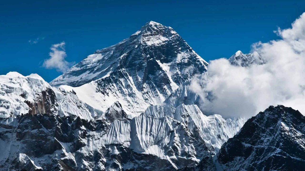
Ask anyone to name Earth’s most dramatic geological feature, and Everest comes up almost instantly. At 8,849 meters above sea level, it’s the tallest point on the planet’s surface. It dominates geography textbooks, bucket lists, and the cultural imagination of exploration.
The assumption runs deep: the most extreme structures on Earth are the ones we can see. Mountain ranges, ocean trenches, volcanic arcs. These are the landmarks that define geological scale in the public mind.
There’s also a quieter assumption underneath that: Earth’s interior is relatively uniform. Hot, dense, and largely featureless beyond the basic layers of crust, mantle, and core. Most people picture something like a hard-boiled egg, just much hotter.
KEY TAKEAWAY
Two underground structures beneath Africa and the Pacific rise approximately 1,000 kilometers from the core-mantle boundary, making them roughly 100 times taller than Mount Everest.
The First Crack: Ocean Rock at the Top of Everest
Before we get to what’s underground, consider what’s already strange about Everest itself. The very summit of the world’s highest mountain is composed of marine limestone. Fossils of ocean-dwelling creatures sit at 8,849 meters above sea level, embedded in rock that was once part of a seafloor. Everest was once at the bottom of the Tethys Sea, and tectonic forces pushed it skyward over tens of millions of years.
That fact alone should calibrate our intuitions. The surface of Earth is not static. It folds, subducts, and rises. What looks permanent is just slow-motion chaos.
If the surface can hide that kind of history, what might the deep interior be concealing? The answer, it turns out, is structures so large they make the surface geology look like wrinkles on a bedsheet.
IMPORTANT
The core-mantle boundary sits approximately 1,800 miles below Earth’s surface. No drill, no probe, and no human instrument has ever reached it directly. Everything we know comes from seismic wave analysis.
The Scale Comparison That Changes Everything
Structure
Height / Depth
Location
Known Since
Mount Everest
8.8 km above sea level
Himalayas, Nepal/Tibet
1856 (surveyed)
Mariana Trench
11 km below sea level
Western Pacific Ocean
1875 (HMS Challenger)
African LLSVP
~1,000 km tall
Core-mantle boundary, beneath Africa
Mapped fully in 2025
Pacific LLSVP
~1,000 km tall
Core-mantle boundary, beneath Pacific
Mapped fully in 2025
What the New 3D Mantle Map Actually Found
The research team, led by Sujania Talavera-Soza at Utrecht University, analyzed 104 large earthquakes recorded between 1975 and 2018. Collaborators included Laura Cobden, Ulrich H. Faul from MIT, and Arwen Deuss from Vassar College. Together, they built a global model called QS4L3, the first 3D map of seismic attenuation across the entire mantle.
Geological Scale Comparison: Surface vs. Deep Earth Structures
Interactive data visualization
Mount Everest
8.8
56
Mariana Trench
11
75
African LLSVP
1,000
225
Pacific LLSVP
1,000
225
Height (km)
Discovery Year (offset from 1800)
Source: Nature (2025), USGS, NOAA
Seismic attenuation measures how much a seismic wave is absorbed or weakened as it travels through rock. Hotter, softer, or partially molten material absorbs more energy. Cooler, rigid rock lets waves pass through cleanly. By mapping these differences globally, the team could identify regions of dramatically different composition and temperature deep inside the Earth.
Mount Everest
VS
African and Pacific LLSVPs
8.8 kilometers tall above sea level
Approximately 1,000 kilometers tall each
Summit made of ancient ocean limestone
Hotter than surrounding mantle rock
Formed by tectonic collision 50 million years ago
Cover roughly 25% of the core-mantle boundary
Fully surveyed and mapped since 1856
First fully 3D mapped in January 2025
VERDICT: The LLSVPs are roughly 100 times taller than Everest and cover a quarter of Earth’s core-mantle boundary, making them the largest geological structures on the planet by a vast margin.
104
Large earthquakes analyzed, spanning 43 years of seismic data from 1975 to 2018
750 mi
Height above core-mantle boundary where LLSVP low-attenuation patterns extend
What emerged were two enormous anomalies: the Large Low-Seismic-Velocity Provinces, or LLSVPs. One sits beneath Africa. One sits beneath the Pacific Ocean. Both are hotter than the surrounding mantle, both absorb seismic waves differently, and both rise approximately 1,000 kilometers from the core-mantle boundary, which itself sits roughly 1,800 miles beneath Earth’s surface.
⚡What Would You Do?
A new seismic survey suggests a mantle plume from the Pacific LLSVP is intensifying beneath a populated volcanic island chain. Governments must decide how to respond with incomplete data and significant economic stakes.
Cautious
Residents are displaced and tourism collapses, but if an eruption occurs, lives are saved. If it doesn’t, public trust in scientific warnings erodes.
Evidence-Based
More precise data emerges over 6-12 months, allowing targeted response. Risk window remains open during that period.
Dangerous
Short-term stability is preserved, but if eruption occurs without warning, the human and economic cost is catastrophic.
The LLSVPs together outline roughly a quarter of the entire zone where the mantle meets the outer core. These are not small anomalies. They are continental-scale features at the very base of the planet’s rocky interior.
25%
Of the core-mantle boundary is outlined by these two giant underground structures
Why the Pacific Ring of High Attenuation Matters Too
The LLSVPs weren’t the only discovery. The new QS4L3 model also revealed a broad ring of high seismic attenuation encircling the Pacific in the lower mantle. High attenuation means more energy is being absorbed, which points to hotter, softer, or compositionally distinct rock.
Our Understanding of Earth’s Interior: Before and After QS4L3
BEFORE 2025
Scientists had seismic velocity maps showing where waves travel faster or slower through the mantle, giving a partial picture of deep Earth structure. The LLSVPs were known to exist but their full 3D shape, attenuation properties, and thermal character remained poorly constrained.
AFTER QS4L3 (2025)
The first complete 3D seismic attenuation map of the entire mantle reveals the precise shape, height, and energy-absorbing properties of both LLSVPs. Scientists can now distinguish temperature from compositional effects, opening a new chapter in understanding how Earth’s deep interior drives surface geology.
This ring likely corresponds to ancient oceanic plates that subducted into the mantle over hundreds of millions of years. As tectonic plates dive beneath one another, they don’t just disappear. They sink slowly, carrying cold material deep into the mantle, where it eventually heats up and interacts with the surrounding rock in ways that leave distinct seismic signatures.
“The new map is described as the first 3D map of how the entire mantle absorbs seismic energy, revealing structures that have been shaping Earth’s surface for billions of years without anyone fully seeing them.”
— QS4L3 Study Summary, Nature, January 2025
The mantle is not a passive layer sitting between the crust and core. It is an active, slowly churning system that drives plate tectonics, fuels volcanic hotspots, and shapes the continents above it. The LLSVPs appear to be anchors in this system, stable structures that have persisted for potentially billions of years at the base of the mantle.
What These Underground Giants Mean for the Surface World
This isn’t purely academic. The LLSVPs are believed to be connected to some of Earth’s most dramatic surface events. Large igneous provinces, the catastrophic volcanic outpourings that have repeatedly reshaped continents and driven mass extinctions, appear to originate above these deep structures. The Deccan Traps in India and the Siberian Traps in Russia, both linked to mass extinction events, may have been fed by plumes rising from the edges of LLSVPs.
From Deep Mantle to Surface: The Chain of Influence
Step 1: Thermal Anomaly
LLSVPs accumulate heat at the core-mantle boundary, creating regions hotter than surrounding mantle rock.
Step 2: Mantle Plume Formation
Hot material rises in columns called mantle plumes, ascending through 1,800 miles of rock over millions of years.
Step 3: Hotspot Volcanism
Plumes reach the crust and create volcanic hotspots. Hawaii sits above a plume likely rooted near the Pacific LLSVP.
Step 4: Continental Reshaping
Over geological timescales, these plumes break apart continents, flood landscapes with lava, and alter the planet’s surface entirely.
Hawaii’s volcanic chain is one modern example. The hotspot feeding those islands is thought to connect to the Pacific LLSVP far below. Every time Kilauea erupts, it is, in a sense, the surface expression of something that began nearly 1,800 miles underground.
Understanding the precise shape, temperature, and composition of the LLSVPs could eventually improve forecasts of volcanic activity and help scientists understand the long-term stability of tectonic plates. That has real implications for populations living above active volcanic zones across the Pacific Rim and East Africa.
1,800 mi
Depth of the core-mantle boundary, where both LLSVPs anchor at the base of the mantle
2025
Year the first complete 3D seismic attenuation map of the entire mantle was published
The QS4L3 model is also a methodological leap. Previous seismic studies mapped velocity variations in the mantle, showing where waves travel faster or slower. This new study maps attenuation, a different property that reveals information about temperature, partial melt, and composition that velocity alone cannot capture. The two approaches together give scientists a far richer picture of what the mantle actually contains.
Everest will always be the highest point you can stand on. But the structures that actually define this planet’s character, that drive its volcanism, shift its continents, and connect its surface to its core, are buried 1,800 miles down, invisible, ancient, and almost incomprehensibly large. The mountain that took centuries to measure is, by every geological standard, a footnote.
⚡What Would You Do?
A new seismic survey suggests a mantle plume from the Pacific LLSVP is intensifying beneath a populated volcanic island chain. Governments must decide how to respond with incomplete data and significant economic stakes.
Cautious
Residents are displaced and tourism collapses, but if an eruption occurs, lives are saved. If it doesn’t, public trust in scientific warnings erodes.
Evidence-Based
More precise data emerges over 6-12 months, allowing targeted response. Risk window remains open during that period.
Dangerous
Short-term stability is preserved, but if eruption occurs without warning, the human and economic cost is catastrophic.
This is an illustrative scenario — not financial or professional advice. Consult a qualified professional for your situation.
The Editorial Team is the named, credentialed group responsible for every article on this site. Each piece is researched by a section editor, reviewed by a credentialed practitioner where the topic warrants it, and signed off by the Editor in Chief before publication. The corrections process is public; named editors are accountable.



Leave a Reply